Today I’m splitting Michigan up the middle on US127 and heading for the Mackinac Bridge and Sault Ste. Marie. I’ve gotten a late start, so I won’t get too far, but that’s all right, because the weather is cooler. It’s still sunny too.
Mackinac is Canadian French, short for Michilimackinac, from early Ojibwa “Missilimaahkinaank” which means “at the territory of the Mishinimaki”. The French pronounced it “aw” but spelled it “ac”. The British heard it pronounced “aw” so they spelled it that way. Whichever way you see it spelled, it is always pronounced “aw”.
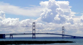 The Mackinac Bridge in northern Michigan is five miles long. At mid-span the road is 199 feet above the water. Construction began in May of 1954, and it opened for traffic on-schedule in November, 1957. Five men lost their lives during construction. To paint it takes seven years, and then they start all over again.
In 1989 a Yugo was blown off of the bridge in a bad windstorm, and in 1997 an SUV was driven off of it.
Residents of the Upper Peninsula (“Yoopers”) often refer to Lower Peninsula residents as “trolls” because they live “below the bridge.”
The wind howls across the roadway, and although it can be a little unnerving, I’ve crossed the bridge many times, by both car and motorcycle. On the bike I just angle over into the wind and I’m across in no time.
A motorcycle tends to wander a bit in the grate-covered lane, but that’s no problem. It’s completely normal. Relax your grip on the bars a bit and let it wander. If you’ve never experienced that sensation before, you’ll get the hang of it after a mile. The speed limit on the bridge isn’t so great that you’ll feel uncomfortable.
Crossing into Canada went trouble-free, and from the border I headed north on the Trans-Canada Highway along the north shore of Lake Superior to Wawa. There’s plenty of bush, lakes and animals on this road, not to mention the mosquitoes and the flies. It’s isolated and lonely riding, but that makes the fuel stops entertaining for the characters that cross your path. It’s also a huge tourist area in the summer, and businesses sell all manner of trinkets to foreigners (Canadian as well as international) who come up here by car or tour bus to experience the bush.
Vehicles aren’t an option in this part of the world. You either own one or you stay where you are until the Greyhound bus arrives, and then you’re at the mercy of their timetable. If you’re off the beaten path, you’re even more isolated as electricity is not an option for most summer or winter cottages in this area. Of course, all the towns have electricity. In the winter, snowmobiling and ice fishing are big here.
Better them than me. I’m always glad I’m just passing through areas like this, although it is very pretty country to see.

 In early July of 1874, the great trek by the North West Mounted Police to bring law and order to the Canadian West began. Two hundred and seventy-five men, half as many oxen, 90-odd cattle, 310 horses, 114 Red River carts, 73 wagons, field guns, mortars, forges and field kitchens all tagged along.
 A gorgeous city in the summer turns into a nightmare in winter. It can go to -40F here in January for three weeks. A blizzard can and does shut town the city for three or four days, three times each winter. With the wind the snow can pile up in drifts up to a garage roof if your home happens to face in the wrong direction. It’s horrible. Ask me how I know!

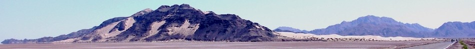
 North of Wawa the road heads inland for 116 miles and then Marathon comes into view on a peninsula into Lake Superior. There are three gold mines east of Marathon, but you won’t be stopping for a tour to see the sights. You’ll never get in.
